Mount Tripyramid loop
The Tripyramid loop is a difficult hike. There are three summits: North Peak [4180 ft.], Middle Peak [4140 ft.], and South Peak [4100 ft.]. There are magnificent views from many points on this trail.
Distance: 10.2 miles
Elevation Gain: 2,903 feet
Time: 5-7 hours
The Mount Tripyramid Loop Trail begins in the Livermore Road parking lot. Walk past the information stand and fee area and turn left down the gravel path. You will follow Livermore Road for quite some time.
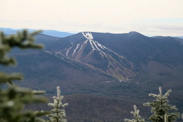
As you hike up from the valley, there are two trailheads for Mount Tripyramid. The first, leads to the South Slide. You want the second, half an hour later, at a hairpin turn. It immediately descends down to Avalanche Brook, crosses it, and continues on a long traverse parallel to the brook to the bottom of the North Slide. It's recommended to ascend the North Slide and descend the South Slide, because the North Slide is extremely steep and exposed in sections, and more difficult to descend, especially in wet conditions.
Once on the Slide, the trail is straight up and very steep on slabs and ledge rock. The easiest route is to begin on the left hand side, and angle toward the center and eventually end at the upper right-hand corner of the slide, where the trail re-enters the woods. The views are best before the slide narrows at the end. Once in the woods, there's a short steep section through thick conifers to the summit.
Hiking across the summits is a beautiful undulating route, passing the Sabbaday Brook Trail junction on the left about half way across. Coming down from the South Peak is a short steep section through thick conifers. When descending the South Slide, which is steep, but not so precipitous as the North Slide, the Kate Sleeper Trail diverges to the left almost immediately.
The Mount Tripyramid trail re-enters the woods at the bottom right of the slide. From there, it descends the steep mountainside on a long traverse, eventually joining an old logging road grade running parallel to the Slide Brook, before crossing Avalanche Brook (difficult in high water), just before it rejoins Livermore Road.