Waterville Flume
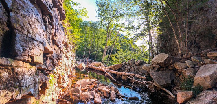
Known to locals as one of the most underrated natural features in the White Mountains, the Waterville Flume is a gorge with 60+ foot walls cut into the mountains by Flume Brook.
Distance: 5.4 Miles (round trip)
Elevation Gain: 1,190 feet
Time: 2-4 Hours
To get to The Waterville Flume you will park at the Livermore USFS Fee lot. Take a left on Livermore Road and begin hiking north for about .9 miles. You will take a left when you see a sign marked Kettle’s Path/Irene’s Path.
Follow Irenes Path for about a mile and as it meanders up one hill, stays flat for a bit, and then climbs sharply up another. Around the top of the second hill you will see a yellow sign marking the spur trail to The Scaur. It is a short steep trail to The Scaur, which offers wonderful views of Waterville Valley, Mount Tecumseh, and the Sandwich Range.
Continue on Irenes path as it climbs Scaur Ridge before dropping down into the next valley on a series of steep switchbacks. Look out for a clearing on one of the corners that offers a northern view of East Osceola and Mad River Notch.
About a mile after The Scaur Spur Trail you will come to a junction with the Old Skidder Trail. Stay left and the Flume is about .2 miles further down the trail.
Look below to see our photo gallery of this hike. If you snap any of your own photos be sure to tag @waterville_valley.