The Scaur
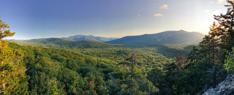
The Scaur is a rocky hill that juts out of the northeast portion of the Valley. It offers beautiful views of the Ski Area, the Valley, and the Mountains that encircle it.
Distance: 4.2 Miles
Elevation Gain: 583 Feet
Time: 1.5-2.5 Hours


To get to The Scaur you will park at the Livermore USFS Fee lot. Take a left on livermore road and begin hiking north for about 25 minutes. You will take a left when you see a sign marked Kettle’s Path/Irene’s Path.
Follow Irenes Path for about a mile and as it meanders up one hill, stays flat for a bit, and then climbs sharply up another. Around the top of the second hill you will see a yellow sign marking the spur trail to The Scaur. It is a short steep trail to your destination.
Take in the wonderful views of Waterville Valley, Mount Tecumseh, and the Sandwich Range and then return the way you came. Or, if you would like to explore further, you could continue to follow Irene’s path to the Waterville Flume.
Look below to see our photo gallery of this hike. If you snap any of your own photos be sure to tag @waterville_valley.